Analysis of Ice Melting from Satellite Images Using MATLAB
This project focuses on analyzing ice melting behavior using image processing techniques. By working with sequential images, it aims to observe changes in ice shape and size over time and transform visual data into measurable insights using MATLAB.
Tracking ice melt accurately is difficult due to variations in lighting, reflections, and irregular ice boundaries. Manually measuring these changes is time-consuming and inconsistent, making it hard to quantify melt rates in a reliable and repeatable way.
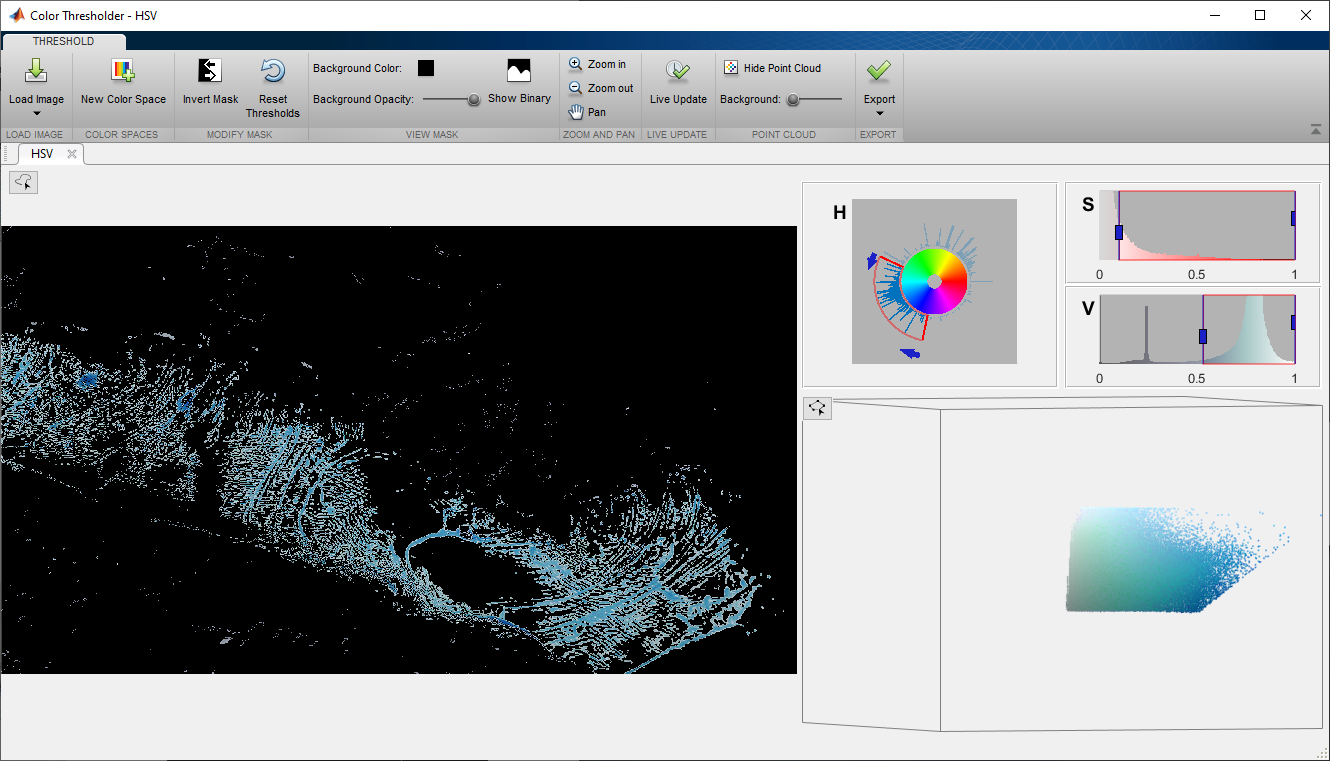
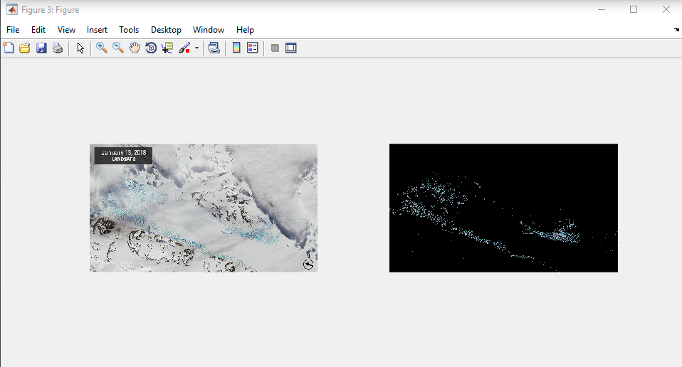
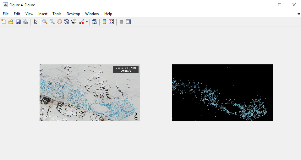
The project applies automated image preprocessing, boundary detection, and analysis techniques to isolate the ice and measure its evolution over time. This approach enables consistent calculation of melting dynamics and clear visualization of results, providing a practical framework for studying ice melt through images.
Key Technical Features
- Automated image preprocessing to enhance contrast for accurate ice detection
- Ice boundary extraction using image segmentation techniques
- Quantitative melt rate calculation based on changes in ice area over time
- Visual analysis and plotting tools to track and compare ice melting dynamics